Honouring the Sacred Volcano: Mount Batur Rules & Guidelines
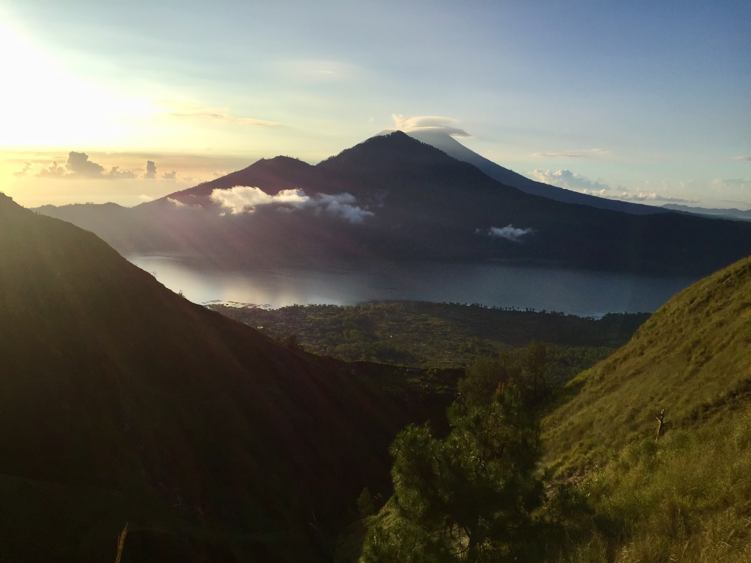
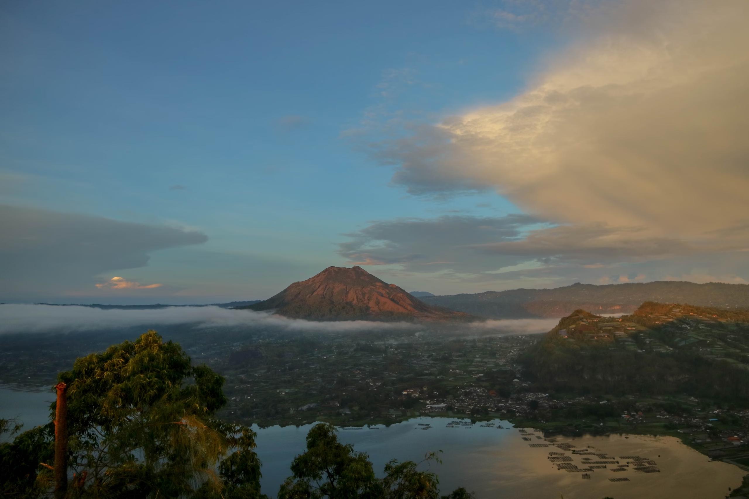
Selamat datang. My name is Wayan Oka. I grew up at the foot of Mount Batur in Kintamani, tending Arabica coffee bushes on land my grandfather farmed before me. In our highland villages, we do not view this volcano simply as a geological landmark. Mount Batur rises 1,717 metres (5,633 feet) above sea level in the Bangli Regency of Northeast Bali, and to us, it is a living, breathing sacred presence. Every rock, steam vent, and trail is part of a delicate spiritual landscape guided by Tri Hita Karana, the ancient Balinese Hindu philosophy of harmony between people, nature, and the divine spirit.
When visitors ask about the rules for hiking our volcano, I tell them these guidelines are not administrative red tape. They are the same principles that keep our mountain safe, clean, and respected for generations. Whether you are stepping onto the dark basalt trails at 03:00 AM or watching the sky turn gold over Lake Batur, knowing what is expected helps you move through our home with grace and safety lah.
Understanding mountain guidelines is like growing coffee. You cannot rush the harvest, and you must respect the soil if you want a sweet cup.
Mandatory Local Guide Policy
A frequent question from travelers planning their trip is: can you climb mount batur on your own? The direct answer is no. Local regulations set by traditional village authorities, known as desa adat, and regional government decrees require every trekker to be accompanied by a licensed guide. Independent hiking without a registered local guide is strictly restricted, with checkpoints stationed along access paths around Toya Bungkah and Pura Jati.
The Association of Mount Batur Trekking Guides manages all trail safety. Local guides are born and raised in Kintamani villages. They know every shifting gravel slope and monitor subtle changes in volcanic steam. Association policy dictates a guide-to-guest ratio of one certified local guide for a maximum of four trekkers. This rule exists because pre-dawn hiking in complete darkness carries real hazards on steep volcanic scree.
The standard mount batur guide price is bundled into recognized trekking packages, which include mandatory permit fees, equipment like headlamps, and basic summit breakfast. You can check current options and reservation details on our booking hub page. Hiring a local guide supports sustainable community livelihoods across Kintamani, ensuring tourism benefits the families who care for the mountain environment.
Sacred Geography & Cultural Etiquette
Mount Batur is active volcanic land, but it is also active spiritual ground. Temples like Pura Pasar Agung sit directly on the slopes, acting as spiritual guardians for the island. When you trek here, you walk through places where local villagers offer daily prayers (*canang sari*) to ask for protection and fertile soil. This black volcanic soil is where my ancestors grew coffee on.
Respecting sacred geography means adhering to clear cultural protocols throughout your hike. Avoid climbing on temple walls, touching stone shrines, or stepping on banana-leaf offerings placed along the trail. Speak quietly during the ascent, as loud shouting or coarse language disrupts both the peaceful nature and the spiritual atmosphere of the crater rim.
During specific Balinese Hindu religious ceremonies, such as Galungan, Kuningan, or temple anniversaries (*odalan*), certain paths or peak sections may close to tourists. Local guides always receive notice from village elders about temple schedules. Following their instructions keeps your trek harmonious and culturally respectful. You can read more about local customs and regional highlights in our experiences and activities guide.
Dress Code & Summit Attire
Many visitors arriving from warm coastal areas like Seminyak or Canggu are surprised by mountain temperatures. If you wonder how to dress for mount batur, preparation starts with understanding our alpine microclimate. Before dawn at the 1,717-metre summit, temperatures drop between 12°C and 15°C, accompanied by strong winds across teh crater rim.
A smart three-layer system works best for the climate conditions:
- Base Layer: A moisture-wicking synthetic or merino shirt to keep sweat away from your skin during the uphill walk.
- Insulating Layer: A lightweight fleece or compact thermal sweater for cold resting periods at the summit.
- Outer Shell: A windproof and water-resistant jacket to block chilly morning gusts.
- Pants & Footwear: Durable long trekking pants and closed-toe hiking shoes with deep tread soles for loose volcanic rock.
Flip-flops, street sneakers with smooth soles, and open sandals are strictly forbidden by guides due to slippage risks on volcanic gravel. Culturally, attire should remain modest when passing through base villages and temple gates. For detailed packing recommendations, consult our packing and clothing guide.
Physical Readiness & Elevation Realities
When guests ask me is it safe to go to mount batur, I reassure them that the climb is very manageable for anyone with moderate physical fitness. However, safety depends on physical preparation and realistic pacing. The ascent covers approximately 300 to 500 vertical metres depending on your trailhead, requiring about two hours of steady uphill walking.
The trail starts with gentle dirt paths through agriculture fields before transitioning into steep volcanic ash, loose basalt gravel, and uneven rock steps. While 1,717 metres is not high enough to cause severe acute mountain sickness, the thin air and rapid elevation gain can trigger mild headaches, lightheadedness, or shortness of breath if you push too fast.
Listen to your guide and maintain a steady, slow rhythm. In Kintamani, we say that pacing a hike is like roasting coffee beans: too much heat too quickly burns the crop. Drink water regularly, take short breaks at designated resting benches, and inform your guide immediately if you feel dizzy or excessively tired during the ascent.
Environmental Stewardship & Geopark Regulations
Mount Batur and its surrounding caldera form part of the Batur UNESCO Global Geopark. This designation recognizes the international geological importance of our double caldera system and Lake Batur. Protecting this environment requires strict adherence to environmental regulations from every visitor.
Single-use plastics are a major threat to our mountain ecosystems. All hikers must pack out every item they bring in, including plastic water bottles, snack wrappers, and tissue paper. Throwing trash into volcanic vents or along forest tracks damages soil health and harms local wildlife, including the long-tailed macaques near the crater summit.
Do not remove volcanic rocks, sulfur crystals, or native plants from the slopes. The black lava fields from historical eruptions represent fragile geological formations that must remain untouched. Stick strictly to established trails to prevent soil erosion along steep ridges.
Weather Preparedness & Safety Protocols
Weather in the Kintamani highlands changes quickly. While dry season months from May to October bring clear skies, sudden cloud cover or rain showers can occur at any time of year. Official weather alerts are issued by the BMKG Indonesia Meteorology Agency, and local guides adjust routing accordingly.
During heavy downpours or severe lightning storms, summiting the open crater rim becomes unsafe. Certified guides hold authority to alter routes, pause hikes at mid-way shelters, or order a descent if weather conditions deteriorate. Safety directives must be followed without argument.
Mount Batur is an active stratovolcano monitored constantly by volcanologists. In the rare event of elevated seismic activity or volcanic gas emissions, local authorities restrict access to specific crater zones. For advice on seasonal weather patterns and optimal hiking months, view our best time to visit planning page.
Trail Etiquette, Drones, & Post-Hike Customs
Hiking Mount Batur is a shared experience enjoyed by hundreds of visitors each morning. Practicing thoughtful trail etiquette ensures everyone enjoys a safe, peaceful morning on the mountian.
Shared Routes & Trail Courtesy
Primary trailheads at Toya Bungkah and Pura Jati feature narrow sections where foot traffic, local motorbikes, and 4×4 volcanic jeeps cross paths near lower trail sections. Always yield the right-of-way to ascending hikers when you are descending. When motorbikes or jeeps approach along wide sandy tracks, step safely to the uphill side of the trail and wait for them to pass.
Keep your headlamp pointed toward the ground rather than into the eyes of oncoming hikers during the early morning climb. If you wish to pass a slower group, notify them politely before stepping around them on wider trail sections. To understand how foot treks compare to vehicle excursions, read our detailed sunrise trekking vs jeep tours comparison.
Photography & Drone Regulations
Capturing sunrise light across the caldera is one of the joys of visiting Kintamani. However, photography comes with responsibilities. Always request permission before taking close photos of local villagers, guides, or priests performing rituals at summit shrines. Guidelines published by the Official Indonesia Tourism Board emphasize respectful cultural photography throughout Bali.
Drones are permitted in open summit areas under reasonable conditions. Maintain safe distances from crowd clusters, do not fly directly over active temple structures, and keep noise levels down so other visitors can enjoy the morning atmosphere. Avoid flying near wild monkeys, as loud rotor noise startles them.
Post-Hike Etiquette in Toya Bungkah
After descending the volcano, many trekkers head straight to the lakeside village of Toya Bungkah to soak in natural geothermal hot springs fed by volcanic heat. When visiting local bathhouses and pools, shower before entering shared hot pools, wear appropriate swimwear, and keep noise levels respectful.
Consider stopping at a family-run warung in Toya Bungkah or Kintamani village for breakfast or fresh coffee. Ordering locally grown Kintamani Arabica supports small farming families directly. You can read about hot spring locations and amenities in our natural hot springs guide, or review transport arrangements on our transport logistics page.
“When you treat the volcano with reverence, the mountain protects your steps and grants you clear skies lah.” — Wayan Oka
Summary of Essential Visitor Rules
| Category | Official Rule / Requirement | Primary Purpose |
|---|---|---|
| Guide Requirement | Mandatory licensed guide (1 guide per max 4 trekkers) | Safety on dark trails and local community economic support |
| Entry Checkpoints | Registration at official trailheads (Toya Bungkah / Pura Jati) | Visitor tracking and UNESCO Geopark management |
| Footwear & Clothing | Sturdy closed-toe hiking shoes and warm layers | Injury prevention on volcanic scree and weather protection |
| Waste Management | Strict zero-litter policy; pack out all trash | Environmental conservation of UNESCO Geopark ecosystem |
| Cultural Respect | Modest behavior near shrines; do not disturb offerings | Honouring Balinese Hindu spiritual traditions (*Tri Hita Karana*) |
| Drone Operations | Fly away from crowds and temples; respect privacy | Safety and preservation of quiet morning environment |