Is Mount Batur Safe? Understanding Volcanic Activity and Volcano Status
Growing up on a small coffee farm in the village of Kedisan along the lower slopes, my morning routine always began with a look toward the summit. Before checking the weather or tending to the coffee trees, my father would glance at the peak to see how high the steam was rising from the central crater. In Kintamani, we live alongside an active stratovolcano that has shaped our soil, our religion, and our daily rhythm for generations. When travelers arrive in our village before dawn, their eyes usually wide with quiet anticipation, the first question they ask is whether Mount Batur is safe to climb. The simple answer is yes, provided you understand the mountain’s character, respect local guidance, and pay attention to proper preparation.
Geological Identity: A Stratovolcano Inside Double Calderas
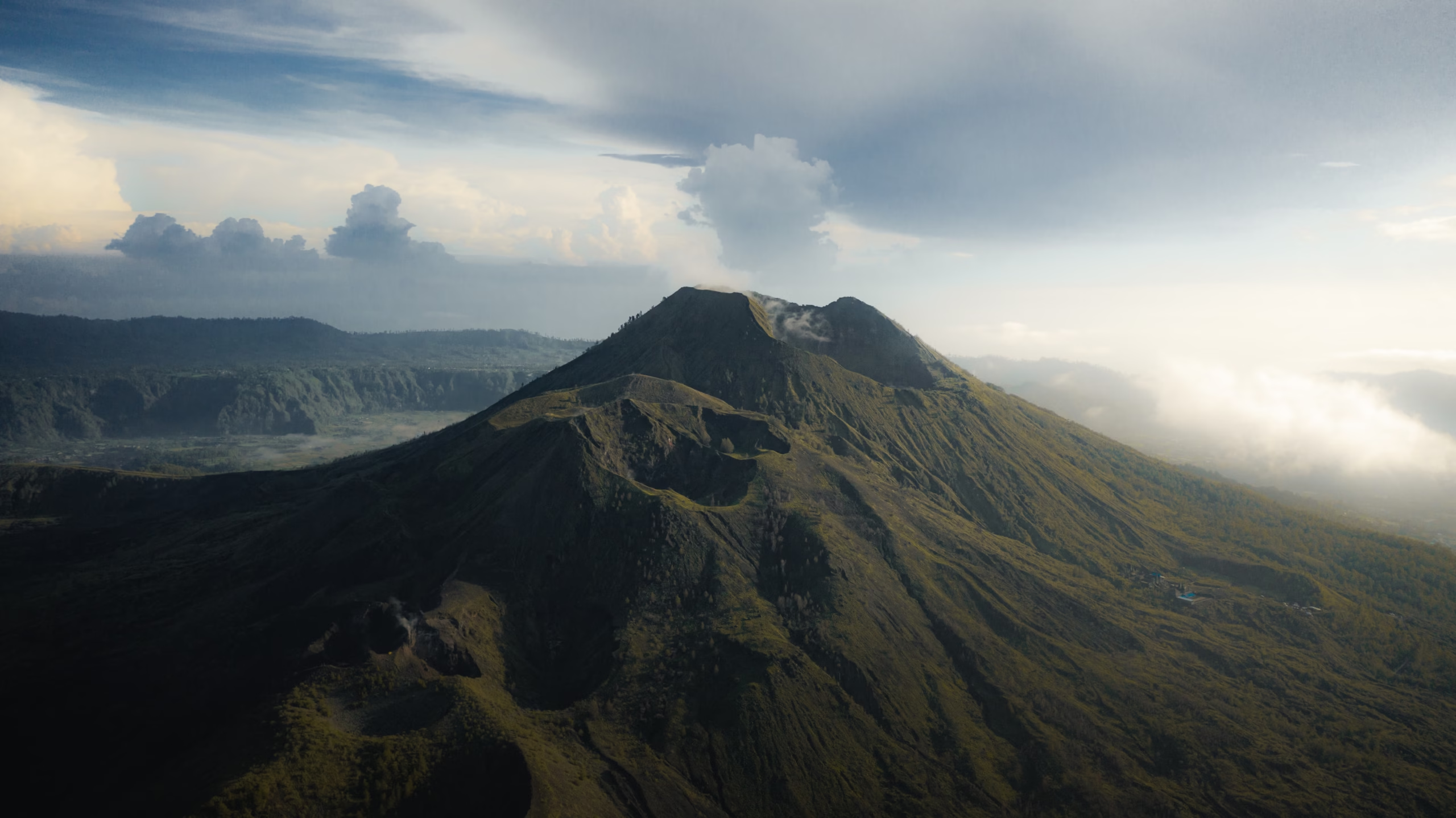
To understand Batur, you have to picture a mountain sitting within a giant natural bowl. Mount Batur is an active stratovolcano situated inside two concentric calderas that were created by colossal prehistoric collapses approximately 29,300 and 20,150 years ago. When those ancient eruptions occurred, the original massive mountain emptied its magma chamber and collapsed inward, leaving the expansive outer rim we see today. Within this outer ring sits a second inner caldera wall, cradling both Lake Batur and the current active cone.
Standing at 1,717 metres above sea level, Batur is significantly lower and less intimidating in elevation than neighboring Mount Agung, which reaches over 3,000 metres. However, its complex volcanic structure features multiple active vents, cinder cones, and fissures spread across the summit area. The crescent-shaped crater lake on the eastern edge acts as a giant natural catchment area, supplying water to the surrounding agricultural land where local farmers cultivate onions, tomatoes, and arabica coffee beans in the rich volcanic soil.
Eruption History: From Ancient Collapses to Recent Decades
A central question many visitors ask is how likely is mount batur to erupt while they are visiting. Looking at historical records provides helpful context for understanding its physical behavior. Recorded activity since the 19th century shows a pattern of mild to moderate Strombolian eruptions, characterized by localized basaltic lava flows, ash clouds, and fountaining rather than massive cataclysmic blasts.
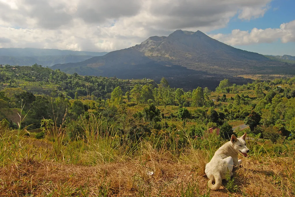
Significant volcanic events occurred in 1804, 1821, 1888, 1905, 1917, 1926, 1963, 1994, 1998, and most recently in 2000. The 1917 eruption was particularly notable because lava flows engulfed the original village of Batur located inside the crater, prompting the villagers to move their homes and their sacred temple, Pura Ulun Danu Batur, up to the higher outer caldera rim where it stands today. The 1926 eruption pushed another black lava stream toward the village of Toya Bungkah. Today, those solidified fields of jagged black basalt remain visible across the southwestern foot of the mountain, serving as a quiet reminder of the earth beneath us.
Current Status and Official Volcanic Monitoring
Volcanic activity in Indonesia is monitored around the clock by the Center for Volcanology and Geological Hazard Mitigation (PVMBG) under the Ministry of Energy and Mineral Resources. Local volcanologists work from an observation station situated on the ridge in Simpar, keeping track of seismic activity, soil tilt, and gas composition around Batur’s craters. Real-time updates are published publicly through the official MAGMA Indonesia platform.
Under the national early warning framework, volcanic threat levels are divided into four clear tiers. Mount Batur consistently rests at Level I (Normal), indicating baseline activity without signs of magmatic movement toward the surface. When you ask if it is safe to go to mount batur today, checking this official classification gives you an immediate, factual answer based on scientific monitoring.
| PVMBG Alert Level | Volcanic Activity Description | Operational Directives for Visitors |
|---|---|---|
| Level I (Normal) | Baseline seismic activity; routine hydrothermal steam emissions. | Open for trekking with licensed guides; crater rim accessible. |
| Level II (Waspada / Alert) | Increased seismic tremors or elevated gas emissions detected. | Summit craters restricted; trekking limited to lower ridges. |
| Level III (Siaga / Standby) | Accelerated seismic unrest; potential small ash eruptions. | All climbing routes closed; safety perimeter established around mountain base. |
| Level IV (Awas / Danger) | Active eruption underway or imminent massive explosive phase. | Complete evacuation of caldera floor; strict exclusion zone enforced. |
Summit Hazards: Sulfur Vents, Steam, and Fumaroles
Hikers reaching the summit crater often wonder can you see lava at mount batur during the climb. The answer is no; there is no liquid magma ocean or open lava lake sitting inside the crater today. Instead, the geothermal energy manifests as hot steam vents, known as fumaroles, and sulfur fissures that release gases from deep underground.
These geothermal vents are hot enough that local guides regularly use them to steam eggs or warm banana sandwiches for hikers enjoying sunrise at the peak. While these steam vents present no danger when treated with caution, they do require sensible behavior. Steam emerging directly from deep crevices can reach temperatures over 100 degrees Celsius, enough to cause severe skin burns if you place your hands directly over an active fissure. Additionally, weak concentrations of sulfur dioxide and hydrogen sulfide gas float around certain crater pockets. Hikers with asthma or severe respiratory sensitivities should remain on upwind viewpoints when spending time near the main crater edge.
Respecting the volcano is like growing coffee. You cannot rush nature, and you must pay attention to the subtle signals the land gives you every morning, lah.
Wayan Oka, Senior Local Guide
Terrain Challenges: Volcanic Gravel, Slips, and Trail Difficulty
When assessing real day-to-day hazards on Mount Batur, physical injuries from slipping present a far greater operational risk than volcanic activity. Understanding how difficult is mount batur requires looking closely at the trail conditions rather than just the overall distance.
The standard ascent covers approximately 3.5 to 4 kilometres each way, gaining roughly 500 vertical metres from the starting points near Toya Bungkah or Pasar Agung. The lower third of the trail winds through pine forests and sandy farm tracks with steady footing. The middle section transitions into steep rock steps formed by ancient lava flows. The final push to the crater rim involves traversing loose volcanic gravel (scree) and fine ash. On this upper section, every two steps forward often feels like sliding one step back.
Common Trail Risks
- Slipping on loose gravel during the steep pre-dawn descent
- Ankle sprains from uneven basaltic rock steps
- Disorientation in darkness before sunrise without adequate lighting
- Sudden leg fatigue caused by steep gradient on loose ash
Effective Prevention
- Wear sturdy trail running shoes or hiking boots with deep tread
- Carry a high-powered headlamp to keep hands free for balance
- Pace yourself steadily rather than rushing the steep scree sections
- Use trekking poles to relieve knee pressure on the descent
Proper flootwear makes an enormous difference to your stability, especially when descending after sunrise when the top layer of volcanic dust becomes slick underfoot. Hikers who attempt the climb in smooth sneakers or casual street shoes frequently lose traction on the descent.
The Role of Mandatory Local Guides
Safety regulations enforced by the Kintamani guide association require all hikers to be accompanied by a licensed local guide. These rules exist not as a mere formality, but as a practical framework to manage crowd flow, assist injured trekkers, and ensure rapid evacuation if weather or geological conditions change unexpectedly.
Local guides grow up navigating these slopes in all seasons. They know which paths turn muddy during sudden downpours, where trail erosion has created unstable edges, and how to pace groups according to varying fitness levels. If a trekker experiences exhaustion or altitude headaches, local guides carry basic emergency equipment and can coordinate quick transport via localized motorcycle response routes on lower mountain tracks. Before finalizing your morning plans, explore current option packages on our tickets page to select registered local guides who adhere strictly to community safety standards.
Weather Dynamics and Pre-Dawn Microclimates
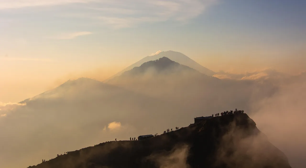
Weather along the Kintamani highlands differs markedly from coastal regions like Seminyak or Canggu. Because the mountain rises to 1,717 metres within an inland elevation zone, temperatures before dawn regularly hover between 10°C and 15°C, dropping lower when cold winds sweep across the crater rim.
A common mistake first-time hikers make is underestimating wind chill while standing still at the summit waiting for sunrise. After sweating during the warm 2-hour climb up, exposed skin cools rapidly under summit gusts, creating uncomfortable shivering or mild hypothermia if proper layers are missing. Carrying a lightweight windbreaker, a warm mid-layer, and a beanie protects you against sudden chill. For detailed guidance on clothing layers and trail equipment, review our comprehensive breakdown on what to pack and wear before heading out.
Rain patterns also shift quickly around the caldera. According to forecasts managed by the Indonesian Agency for Meteorology, Climatology, and Geophysics (BMKG), the dry season between May and October offers the clearest skies and most stable trail conditions. Heavy afternoon downpours during wet season months (November to April) can cause temporary mud channels along lower forest paths, requiring extra care during early morning ascents.
Comparative Risk: Batur vs. Agung and Ijen
Understanding Batur’s safety profile becomes clearer when comparing it with other prominent volcanoes across the region. Travelers exploring Indonesia often group Batur together with Mount Agung in East Bali or Mount Ijen in East Java, yet each peak presents distinct physical conditions.
Mount Agung is a massive, highly explosive stratovolcano rising over 3,000 metres. When Agung erupted in late 2017 and 2018, it produced substantial ash plumes that closed airspace and required large safety exclusion zones. Batur, by contrast, operates on a much smaller scale with lower magmatic pressure and predictable seismic patterns. Meanwhile, Mount Ijen features an acidic crater lake with dense sulfur dioxide gas clouds that require specialized gas masks for visitors descending into its crater. Batur possesses no acidic lake and gas levels on open summit ridges remain minimal under normal weather flow. This makes Batur significantly more manageable for casual hikers, families, and those seeking an accessible mountain experience without extreme alpine exposure.
Volcanic safety is built upon daily scientific monitoring, local experience, and individual preparation working in harmony.
Emergency Protocols and Seismic Contingencies
In teh unlikely event that seismic monitoring stations detect abnormal tremors or deep magmatic displacement, clear emergency procedures take effect immediately. The PVMBG communicates directly with regional emergency agencies, village headmen, and the local guide association in Kintamani.
If alert levels escalate from Level I to Level II, climbing access to the upper crater rim is halted immediately, and entry checkpoints along Toya Bungkah and Pasar Agung are closed by village authorities. Local guides maintain active radio communication during early morning ascents, allowing immediate group re-routing if localized weather or steam discharge increases near specific crater vents. This integrated communication network ensures trekkers can be safely directed down lower mountain roads before any significant risk develops.
Checking Current Safety Data Before You Trek
Before leaving your hotel in the early hours of the morning, taking a few minutes to verify local conditions ensures a smooth trip. Staying informed is straightforward when using verified official channels:
- Review real-time seismic reports on the MAGMA Indonesia portal.
- Check local highland weather reports provided by BMKG for Kintamani district.
- Confirm trail opening status with your licensed guide or driver prior to departure.
- Consult our updated logistical guide on how to get to Mount Batur for real-time travel timing from coastal towns.
If you prefer to enjoy the dramatic landscape without hiking up steep gravel paths, 4×4 options provide a stable alternative. You can learn more about vehicle routes in our comparative guide on sunrise trekking vs jeep tours, which explains how custom vehicles navigate dedicated lower track routes safely.
Respecting the Mountain While Embracing Adventure
Mount Batur remains one of Bali’s most awe-inspiring natural landmarks. It is an active volcano, but it is also a living environment that supports thousands of families through agriculture, tourism, and cultural traditions. When you approach the mountain with standard preparation, sturdy footwear, and respect for local guidance, climbing Batur is a safe, deeply rewarding journey.
After completing your sunrise hike and descending the crater paths, soaking in the geothermal pools down by the lake offers the perfect way to unwind. Discover where to relax in our review of natural hot springs near Lake Batur. Remember to check all official visitor rules and guidelines before arriving, tread carefully along the volcanic ridges, and enjoy the magical morning light over our island home, lah.